
WINNIPEG -- The City of Winnipeg said sandbags have been dropped off at a property that may be at risk of flooding if the Red River rises another three inches.
As of around noon Monday, the Red River sat at 16.75 feet at James Avenue.
Following the October snowstorm, the province’s chief flood forecaster had said the Red was expected to reach peak levels of 16 to 16.3 feet, sometime between Oct. 20 and Oct. 23.
On Monday the province said it’s now expected to peak between Oct. 23 and Oct. 26 in Winnipeg, at 17 to 17.4 feet. It attributed the increase to the lowering of the Floodway gates and an increase in flows on the Assiniboine, caused by snowmelt.
The city said if the river reaches 17 feet, the property where sandbags were delivered may be at risk.
“We will continue to monitor weather conditions and river levels to determine required flood protection measures, and have 21,000 filled sandbags on hand in the event they’re required,” the city said in an email to CTV News.
Upstream, in the Red River Valley between Emerson and Morris, the province said the river is expected to rise another 0.2 to 0.7 feet and will peak in that area between Oct. 24 and Oct. 27.
Further south, the National Weather Service said the Red River sits at a moderate flood stage at Pembina, ND.
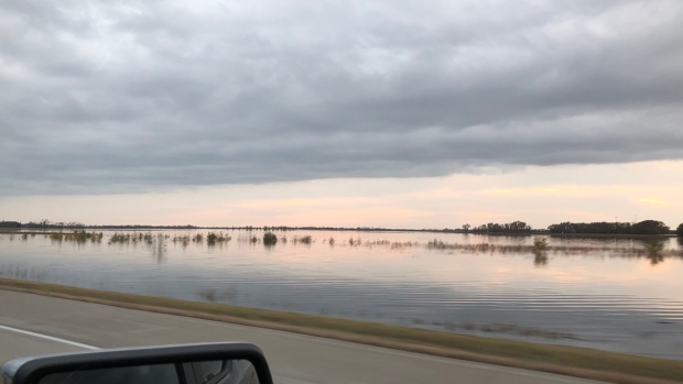
Water on fields between Grand Forks and Pembina, ND, taken Oct. 18, 2019. (Submitted by Trisha Yellow Horn.)
Wind warning issued for Manitoba’s largest lakes
Meantime, the Province of Manitoba said the south basins of Lake Winnipeg and Lake Manitoba could rise as much as five feet or more, thanks to heavy wind.
A high wind-effect warning has been issued for the south basins, especially in the Gimli and Victoria Beach areas.
The province said wind speeds are forecast to pick up Monday afternoon and will stick around until late Tuesday.


