Season's first significant snowfall blankets southern Manitoba
 A Blue Jay is seen feeding in the snow in Deerwood on Oct. 27, 2023 (Image source: Jeanette Greaves)
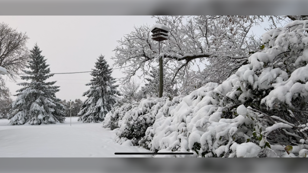
Southern Manitoba awoke to a wintry wonderland Friday, after a pair of systems brought the season’s first heaps of snow.
“The bulk of the snow has passed, so the snowfall warnings have been lifted. But it’s still snowing, and the impact that this weather has already had will also continue,” Environment and Climate Change Canada (ECCC) warning preparedness meteorologist Natalie Hasell told CTV News Winnipeg.
According to an ECCC weather summary issued Friday afternoon, about nine centimetres of snow has fallen in Winnipeg since Wednesday.
Brandon Municipal Airport reported 15 centimetres, while 18 centimetres fell in Morden.
Portage la Prairie, meantime, saw about six centimetres of the white stuff fall.
Hasell notes a couple more centimetres could still accumulate overnight before snow tapers off on Saturday.
 A fresh batch of snow in Carman, Man. is shown in an Oct. 27, 2023 photo. (Source: Tina Doell)
With the ground still warm from above seasonal values last week and temperatures forecasted to peak at or near freezing in southern Manitoba on Friday, some of the freshly fallen snow is likely to melt.
However, flurries are expected once again Monday, this time care of a system coming in from the north.
“We don't know how much snow is likely on Monday. At this point, it's a little far in the forecast to really be accurate,” she said.
Hasell reminded motorists to drive to conditions, as accumulating snow can cause issues with traction and visibility. She also recommended storing an emergency kit in your vehicle.
EL NINO LIKELY TO CREATE MILDER MANITOBA WINTER
Overall, Hasell predicts Manitoba is in store for above-normal temperatures this winter thanks to El Nino.
El Nino is a phenomenon that happens over equatorial waters in the Pacific when a band of warm ocean water develops and affects weather in Canada through teleconnections.
“We’re still going to see a lot of ups and downs throughout the season,” she cautioned.
“But on average, we are expecting temperatures to be above normal this fall and winter and into the early spring based on the El Nino situation.”
Shopping Trends
The Shopping Trends team is independent of the journalists at CTV News. We may earn a commission when you use our links to shop. Read about us.


CTVNews.ca Top Stories

opinion
opinion Tom Mulcair: Prime Minister Justin Trudeau's train wreck of a final act
In his latest column for CTVNews.ca, former NDP leader and political analyst Tom Mulcair puts a spotlight on the 'spectacular failure' of Prime Minister Justin Trudeau's final act on the political stage.
B.C. mayor gets calls from across Canada about 'crazy' plan to recruit doctors
A British Columbia community's "out-of-the-box" plan to ease its family doctor shortage by hiring physicians as city employees is sparking interest from across Canada, says Colwood Mayor Doug Kobayashi.
'There’s no support': Domestic abuse survivor shares difficulties leaving her relationship
An Edmonton woman who tried to flee an abusive relationship ended up back where she started in part due to a lack of shelter space.
opinion
opinion King Charles' Christmas: Who's in and who's out this year?
Christmas 2024 is set to be a Christmas like no other for the Royal Family, says royal commentator Afua Hagan. King Charles III has initiated the most important and significant transformation of royal Christmas celebrations in decades.
Baseball Hall of Famer Rickey Henderson dead at 65, reports say
Rickey Henderson, a Baseball Hall of Famer and Major League Baseball’s all-time stolen bases leader, is dead at 65, according to multiple reports.
Arizona third-grader saves choking friend
An Arizona third-grader is being recognized by his local fire department after saving a friend from choking.
Germans mourn the 5 killed and 200 injured in the apparent attack on a Christmas market
Germans on Saturday mourned the victims of an apparent attack in which authorities say a doctor drove into a busy outdoor Christmas market, killing five people, injuring 200 others and shaking the public’s sense of security at what would otherwise be a time of joy.
Blake Lively accuses 'It Ends With Us' director Justin Baldoni of harassment and smear campaign
Blake Lively has accused her 'It Ends With Us' director and co-star Justin Baldoni of sexual harassment on the set of the movie and a subsequent effort to “destroy' her reputation in a legal complaint.
Oysters distributed in B.C., Alberta, Ontario recalled for norovirus contamination
The Canadian Food Inspection Agency has issued a recall due to possible norovirus contamination of certain oysters distributed in British Columbia, Alberta and Ontario.
Regina
-

Gathering held in Regina to recognize Winter Solstice
Regina's mâmawêyatitân centre held a day of gathering for the Winter Solstice on Saturday.
-
Canada's first sustainable Tim Hortons location to open in Regina this weekend
Canada’s first sustainable Tim Hortons opens in Regina this weekend. The restaurant, located in the city’s east end, features design and operating features that minimize environmental impact.
-
Gravelbourg's transportation program celebrates addition of new vehicle and garage
The town of Gravelbourg is celebrating the addition of a new vehicle and garage which will be used in their local transportation program.
Saskatoon
-

Sask. police investigating mischief incident after bomb report in school
Prince Albert police are investigating a mischief incident after a bomb report in a school Friday afternoon.
-
Prince Albert woman collects donations to make Christmas hampers for community
A Prince Albert woman is spreading holiday cheer by organizing Christmas hampers for those in need.
-
Sask. lawyers defend judge for staying fatal THC-impaired driving charge
The Saskatchewan Trial Lawyers Association is defending a provincial court judge, who’s facing backlash for staying a charge in a high-profile case involving the death of a child.
Edmonton
-

'There’s no support': Domestic abuse survivor shares difficulties leaving her relationship
An Edmonton woman who tried to flee an abusive relationship ended up back where she started in part due to a lack of shelter space.
-
Icy conditions: Alberta RCMP warn of poor driving conditions on QEII between Leduc and Red Deer
Alberta RCMP issued a warning to drivers Saturday morning about slick conditions on the QEII between Leduc and Red Deer.
-
Heavy police presence in south Fort McMurray: RCMP
RCMP warned Fort McMurray residents Saturday night about an unfolding police incident in Beacon Hill.
Calgary
-

'This shouldn't happen': Calgary family seeks changes after WestJet accessibility incident
A Calgary woman wants WestJet to apologize to her daughter and to improve staff training on accessibility after an incident during their latest trip.
-
Promise of high-level hockey comes at a cost for prep school players at Circle K Classic
Calgary is set to host the Circle K Classic, welcoming some high-end talent and pricey prep schools for the annual U18 AAA hockey tournament.
-
Flames get goals from 6 players in a 6-4 victory over the Blackhawks
Jonathan Huberdeau, Connor Zary, Blake Coleman, and Matt Coronato each had a goal and an assist as the Calgary Flames beat the Chicago Blackhawks 6-4 on Saturday.
Toronto
-

Man arrested for allegedly sexually assaulting a minor in Mississauga
Peel police have arrested a suspect who allegedly sexually assaulted a female minor in Mississauga's Square One area on Dec. 9.
-
Toronto opens 2 more warming centres as temps dip below -15 C
Toronto is opening two additional warming centres at 5 p.m. on Saturday to support people experiencing homelessness as the temperature is expected to dip to a chilly -15 C.
-
Leafs captain Auston Matthews misses game against Islanders with undisclosed injury
Maple Leafs captain Auston Matthews sat out Saturday night’s game against the New York Islanders with an undisclosed injury.
Ottawa
-

Ottawa Senators fans, organization embracing 'mullet man' mascot
Gatineau-based Ottawa Senators Jay Trepanier has been dubbed the "mullet man" after his flowing haircut caught the attention of the television cameras during a game in October.
-
What's open and closed in Ottawa over the holidays
CTVNewsOttawa.ca takes a look at what's open and closed over the Christmas and New Year's holidays this year.
-
Ottawa MP Mona Fortier appointed chief government whip
Ottawa-Vanier MP Mona Fortier has been appointed as chief government whip, the latest addition in a major reshuffle of Prime Minister Justin Trudeau's cabinet.
Montreal
-

Major factory fire in the Maskinonge, Que.
A major fire devastated an industrial building in the municipality Maskinongé, Que on Saturday.
-
West Island clinic set to close at the end of December
Statcare Emergency Clinic in Pointe-Claire will shut its doors on Dec. 31.
-
Here's how you can watch CTV News Montreal at Six on Saturday during the NFL season
With CTV broadcasting NFL football games on Saturdays this season, CTV News Montreal at Six will be broadcasting live on our website and the CTV News App.
Atlantic
-

Cancellations, closures accompany Maritime storm
There are a number of closures in the Maritimes Saturday after a nor'easter brought heavy snow to parts of the region.
-
Calling all bloodhounds: These P.E.I. blood donors have four legs and a tail
Dogs are donating blood and saving the lives of canines at the University of Prince Edward Island's Atlantic Veterinary College in Charlottetown.
-
Youth dies following accident in Moncton, N.B.
RCMP in Moncton, N.B., said one of two passengers, a youth, involved in an accident on Monday, has died in hospital as a result of his injuries.
Vancouver
-

Man wounded in Mission, B.C., shooting
One man was injured in a shooting in the Lower Mainland city of Mission Saturday morning, Mounties confirmed.
-
Winds exceeding 120 km/h reported in parts of B.C. coast
Residents of parts of the British Columbia coast are again bracing for high winds, with gusts forecasted to reach 110 km/h in some areas.
-
2 dead after car crash in Burnaby
Two people were killed in a car crash in Burnaby early Saturday morning, police confirmed.
Vancouver Island
-

B.C. mayor gets calls from across Canada about 'crazy' plan to recruit doctors
A British Columbia community's "out-of-the-box" plan to ease its family doctor shortage by hiring physicians as city employees is sparking interest from across Canada, says Colwood Mayor Doug Kobayashi.
-
B.C. woman with photographic memory strives to make unforgettable Christmas displays
Although Alisha Pauling is looking through old pictures, she doesn’t need them to remember her Christmases past. She has a photographic memory.
-
Internet stranger's kind gesture restores Canucks fan's faith in humanity
A Nanaimo, B.C., couple is in awe at the kindness of an internet stranger who helped them track down a coveted Christmas gift.
Kelowna
-

Forfeited Hells Angels clubhouse in Kelowna, B.C., sold to the city
A former Hells Angels clubhouse that was seized by the British Columbia government in 2023 after years of fighting in court has been sold to the City of Kelowna.
-
Death of woman found in Kelowna's Waterfront Park in June deemed 'non-criminal in nature': RCMP
Police in Kelowna say a death they began investigating back in June has now been confirmed as "non-criminal in nature."
-
B.C. man sentenced for 'execution-style' murder of bystander in drug trade conflict
A B.C. man convicted of the "intentional and ruthless killing of a bystander" while acting as an enforcer in the drug trade has been sentenced for a second time in the slaying.
N.L.
-

Newfoundland woman washed sick patients' hair every Saturday for more than 20 years
A retired nurse and teacher in Newfoundland was honoured this week for her volunteer work, which included more than two decades washing the hair of bedridden hospital patients.
-
Newfoundland man facing more charges related to youth sex crimes
A 64-year-old Newfoundland man charged with dozens of sex crimes involving young people is facing several new charges.
-
After fanfare of Churchill Falls deal, Newfoundland urged to learn its dam lessons
Energy observers in Newfoundland and Labrador are urging the provincial government to take a sober second look at a massive tentative deal announced last week with Quebec that promises to deliver hundreds of billions of dollars in revenue to the Atlantic province.
Northern Ontario
-

Robinson Superior First Nations provided settlement offer from Canada over annuities owed
Details haven’t been made public yet about the settlement offer presented on Friday by Canada to the 12 First Nations in the Robinson Superior Treaty Territory.
-
Northern Ont. man illegally killed three moose, one deer
A man from the northwestern Ontario community of Dinorwic has been found guilty of multiple hunting offences and fined $6,500, banned from hunting for five years and placed on probation for 18 months.
-
opinion
opinion Tom Mulcair: Prime Minister Justin Trudeau's train wreck of a final act
In his latest column for CTVNews.ca, former NDP leader and political analyst Tom Mulcair puts a spotlight on the 'spectacular failure' of Prime Minister Justin Trudeau's final act on the political stage.
Barrie
-

One driver faces several charges following Highway 400 crash in Oro-Medonte
Traffic came to a standstill Friday afternoon following a single-vehicle collision on Highway 400 in Oro-Medonte.
-
High school teacher charged with sexual assault amid allegations involving a student
A 51-year-old teacher from Georgina has been charged with sexual assault following allegations involving a student.
-
Hospice Simcoe mourns loss of COPE service pup, after 7.5 years of service
The Hospice Simcoe community is mourning the loss of their Canine Opportunity, People Empowerment (COPE) service dog, Daisy.
Kitchener
-

'I'm still thinking pinch me': lost puppy reunited with family after five years
After almost five years of searching and never giving up hope, the Tuffin family received the best Christmas gift they could have hoped for: being reunited with their long-lost puppy.
-
Impaired driver causes significant delays on Waterloo highway
A 24-year-old man is facing charges after driving while drunk across two Waterloo Regional highways on Friday.
-
Fire destroys home in Haldimand County
A home in Haldimand County has been destroyed after a Saturday afternoon fire.
London
-

New Canadians displaced after fire destroys east London townhome
A family of new Canadians from Nigeria are looking for a new home just before Christmas. Fire destroyed their townhome on Bentley Drive in northeast London, Ont. Friday night.
-
Feeling Festive? Check out this display of over 300 lit Christmas trees
“We have over 300 Christmas trees on display, the majority of them are sponsored and decorated by all of our amazing local businesses,” says Ashley Mason, event and hospitality manager at CASO Station and ECRM in St. Thomas, Ont.
-
Sarnia Police Auxiliary Unit works to return stolen shopping carts to businesses
The high cost of crime is often passed on to consumers – whether it’s shoplifting, vandalism or property damage.


