Here's how much snow fell in parts of Manitoba Sunday
Not so long ago, some were wondering when Winnipeg would finally see the first significant snowfall of the season. We now have our answer.
A low pressure system brought snow, freezing rain and freezing drizzle to much of southern Manitoba starting Sunday.
According to Environment and Climate Change Canada (ECCC) most areas in southern Manitoba ranged between 15 and 20 centimetres of snow, while Winnipeg's range was a bit wider between 11 and 20 cm.
"Generally speaking, we're talking about 15 to 20 for most places, but there were a few bands of more intense precipitation. So I think one of them was right over southern Winnipeg, which is why there's such a range from north to south in the city," said Natalie Hasell, a warning preparedness meteorologist with ECCC.
The Winnipeg airport received 18 cm, while Brandon's airport also received the same amount.
Hasell noted snow isn't rare for December, but the amount of snow we received might be a little more unusual.
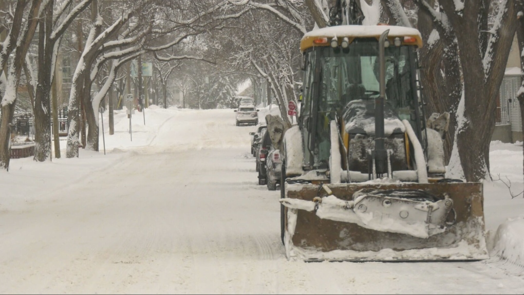 A Winnipeg street is freshly plowed after up to 20 centimetres dumped on parts of the city. Uploaded Dec. 9, 2024. (Joseph Bernacki/CTV News Winnipeg)
"I would say this is a little bit closer to normal (compared to last year), as we do get large storms at this time of year," said Hasell. "But getting near 20 cm of snow when the average for the month is close to 27, that kind of tells you this was quite a lot of snow in one period."
The low has moved into North Dakota, but it will still bring intermittent light snow and blowing snow in strong and gusty northwest winds this afternoon to the Red River Valley. Temperatures will also fall this afternoon.
By early Monday evening, northwest winds will diminish just enough to end most blowing snow across southern Manitoba.
Meanwhile, ECCC has continued a snowfall warning and weather advisory this afternoon for parts of northwestern Ontario.
Round two arrives on Tuesday morning with more light snow across southern Manitoba and northwestern Ontario.
Snowfall amounts won’t be as high as the first system, but this one will deliver a blast of bitterly cold Arctic air from the north. Brace yourself for daytime highs only reaching the mid to low 20s on Wednesday and Thursday.
ECCC said extreme wind chills are likely.
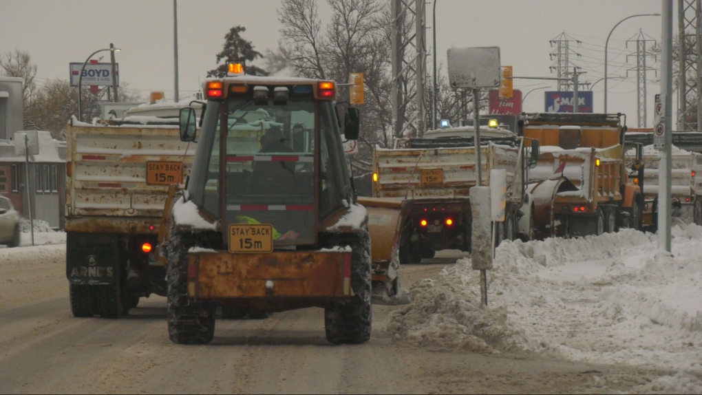 Plows and dump trucks line a Winnipeg street after snow clearing efforts on Dec. 9, 2024. (Joseph Bernacki/CTV News Winnipeg)
"So, pay attention to current conditions, pay attention to the forecast, and to any alerts that might be issued. Have an emergency kit. If you do have to travel, tell people where you're going and how long it's going to take you, so that if you don't show up or don't call in, somebody knows, and maybe they can do something about it. And again, I'll repeat, if you are stuck on the highway in either reduced visibility and blowing snow or in extremely cold conditions, stay in your car."
This will be a brief cold snap, however. Temperatures much closer to normal will return later in the week and on the weekend.
As for the rest of the month, Hasell said a few more systems are expected to roll into southern Manitoba and Winnipeg, meaning more snow is possible.
She also said the province is expecting above-normal precipitation for the winter months.
"I don't know if that means we've already received it and then, you know, we'll just be fine the rest of the winter. Or, what I more expect is the passage of these low and high systems will continue over our area, and we will continue to see these unsettled, variable times where it warms up in advance of a low, then the low dumps its precipitation, probably snow, as we move forward."
CTVNews.ca Top Stories

BREAKING PM Trudeau says he thinks Trump is using talk of Canada becoming 51st state to distract from tariff impact
Prime Minister Justin Trudeau says he thinks U.S. president-elect Donald Trump is drumming up drama on Canadian statehood to detract from tariff talks.
LIVE UPDATES Here's the latest on the most destructive fire in L.A. County history
A series of wildfires are tearing through densely populated parts of the Los Angeles, Calif. area. Five people have been reported dead. U.S. Gov. Gavin Newsom says thousands of resources have been deployed to contain the fires.
Multiple Chinese warships track Canadian HMCS Ottawa through the South China Sea
The silhouettes of a hulking Chinese Navy destroyer dubbed 'Changsha' and a warship called the 'Yuncheng' can been seen hovering along the horizon, mirroring HMCS Ottawa’s movements.
Canadian travellers now require an ETA to enter U.K. Here's what to know
Starting Jan. 8, Canadians visiting the U.K. for short trips will need to secure an Electronic Travel Authorization (ETA) before boarding their flight, according to regulations set out by the U.K. government.
'True when I said it, true today': former Canadian PM Harper pushes back against Trump on social media
Former prime minister Stephen Harper doesn’t find U.S. president-elect Donald Trump’s jibes about Canada becoming the 51st U.S. state very amusing.
Toronto police investigating parental abduction, three-year-old boy believed to be in India
A parental abduction investigation is underway after a father allegedly failed to return to Canada with his three-year-old son after a trip to India, Toronto police say.
More than 150 students sick at University of Guelph, says public health
More than 150 cases of gastroenteritis have been reported at the University of Guelph.
California's insurance is in crisis. The solution will cost homeowners a ton
Lynne Levin-Guzman stood in the front yard of her 90-year-old parents’ home in Los Angeles County, California, trying to protect it with a garden hose — because their insurance company no longer would.
As wildfires rage in Los Angeles, Trump doesn't offer much sympathy. He's casting blame.
As cataclysmic wildfires rage across Los Angeles, President-elect Donald Trump hasn't been offering much sympathy. Instead, he's claiming he could do a better job managing the crisis, spewing falsehoods and casting blame on the state's Democratic governor.


