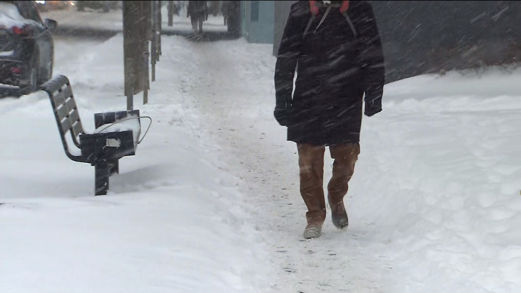
Parts of Manitoba may be in for more snow to start the week

Spring break is just around the corner, but winter weather may be gracing parts of Manitoba to start the week.
Shannon Moodie, a meteorologist with Environment and Climate Change Canada, said a developing system could bring up to 10 centimetres of snow to parts of southern and eastern Manitoba.
"That's really going to start on Monday and persist through Tuesday," said Moodie. "With that, there will be some gusty winds as well, some gusty northerly winds."
As for how this will impact Winnipeg, Moodie said the city is on the fringes of the current system, meaning it's hard to say what will happen.
"There could be lots of changes in its track yet. So Winnipeg could be in that or it could totally be out of it. So it's really difficult when an area is just right on the edge precept shield of a system."
For those who might be driving south for spring break, they should be prepared for snow as well.
Winter storm warnings have been issued in North Dakota and Minnesota according to the National Weather Service.
In the Minneapolis area, the warning is showing snow starting on Sunday and lasting until Monday evening/Tuesday morning. The warning states there could be up to five centimetres falling per hour.
For Grand Forks in North Dakota, the latest information in the warning shows there could be anywhere from 15 to 43 centimetres that falls between Sunday and Tuesday, making travel difficult.
Moodie is reminding people that if they are heading south, they should keep an eye on the forecast.
"If they're travelling, look at the forecast for the area that they're going, in the areas in between, to make sure that they don't run into any inclement weather."
CTVNews.ca Top Stories

Canada could impose tariffs on U.S. steel, orange juice in response to Trump threat
Canadian officials are narrowing a list of American products to target in the event the federal government must respond to U.S. tariffs on Canadian goods, CTV News has confirmed.
Convicted Jan. 6 rioter arrested as fugitive in Whistler, B.C.
An American citizen convicted of participating in the Jan. 6, 2021, riot on Capitol Hill who said he was seeking asylum in Canada has been arrested as a "fugitive from U.S. justice," according to authorities.
Can the U.S. really make Canada the 51st state?
Talk of Canada becoming the 51st American state has raised an existential question on this side of the border: Could it be done? Could the maple leaf make way to the stars and stripes? According to several experts, it may be possible, but not painless.
L.A. wildfires continue to devastate area, Canada prepared to offer expertise
A series of wildfires are searing through the Los Angeles area, forcing many to evacuate their homes. Here's everything that happened throughout Jan. 8.
'True when I said it, true today': former Canadian PM Harper pushes back against Trump on social media
Former Canadian Prime Minister Stephen Harper doesn’t find president-elect Donald Trump’s jibes about Canada becoming the 51st U.S. state very amusing.
Ontario Premier Doug Ford says he is 'OK' after OPP vehicle he was in was 'sideswiped' in Highway 401 collision
Ontario Premier Doug Ford was uninjured after an OPP vehicle he was travelling in was involved in a collision on Highway 401 earlier today.
At least 60 University of Guelph students sick as 'cluster of illness' hits residence
The University of Guelph is dealing with what they are calling a ‘cluster of illness’ among students living in residence.
Energy minister 'committed' to consumer carbon tax as he considers Liberal leadership
Energy and Natural Resources Minister Jonathan Wilkinson says he would be 'committed' to the consumer carbon tax should he become Liberal leader and prime minister, despite the policy’s unpopularity.
New ranking suggests Canada passport among 'top 5 losers' in the world
A new global ranking may raise doubts about Canada's reputation of being open to other countries.


