Rain, snow hit parts of southern Manitoba as system moves north from the U.S.
Parts of southern Manitoba have been hit by a lot of rain, and even snow, as a low-pressure system moves in from the United States.
Natalie Hasell, a warning preparedness meteorologist with Environment and Climate Change Canada, said the areas closest to the Canada-U.S. border received the most precipitation over the last 24 hours.
Both Deerwood and Morden each reported 69 to 70 millimetres of rain just before 3 p.m. Friday.
Pilot Mound had 56 mm, Carman received 58 mm, and Portage la Prairie reported between 40 and 50 mm.
As for Winnipeg, the city recorded between 20 and 25 mm. Hasell noted Winnipeg may miss out on more precipitation Friday, going into Saturday.
"We might be in a bit of a gap. So we might not get quite as much precipitation in Winnipeg proper, but a lot of the areas around us, and not too far away, are looking very likely to reach our warning numbers," said Hasell.
Despite that, the precipitation is still impacting activities in Winnipeg. The Goldeyes announced the team's game scheduled for Friday has been postponed and will be made up on Saturday.
As well, the St. Andrews Lock and Dam may have to remove part of the moveable dam to deal with the significant rainfall.
"Owners of vessels, barges, and all property on the Red River and its tributaries are advised to protect their property," Public Services and Procurement Canada said in a news release.
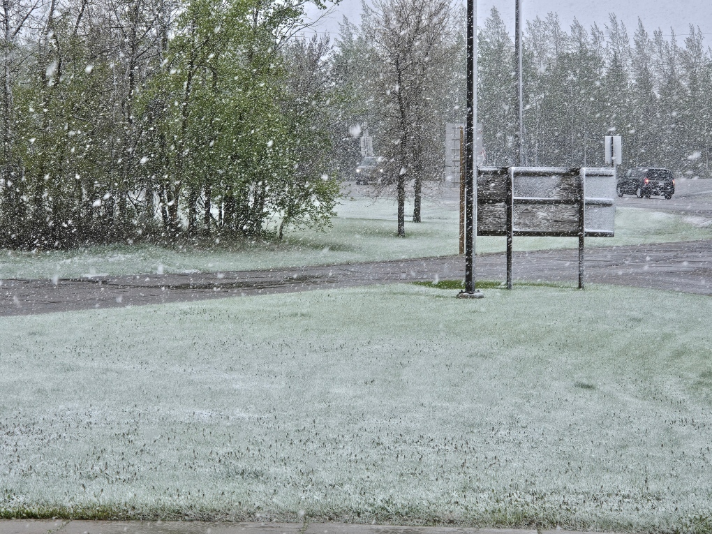
 Snow seen at Highway 16 and Highway 10 on May 24, 2024. (Jason Enns)
It wasn't just rain that Manitobans dealt with, as parts of western Manitoba experienced snow Thursday night and Friday morning.
Riding Mountain National Park reported 10 centimetres of snow, while Shiloh reported 8 cm and Brandon saw 2 cm.
Hasell said there was a spot of cold air that caused the precipitation to come down as snow.
"It's mainly rain mixed with snow. It's not entirely snow because we do have some areas where temperatures are just above zero at the surface. It's a bit messy."
She added the snow wasn't a surprise as a number of models were suggesting snow was possible.
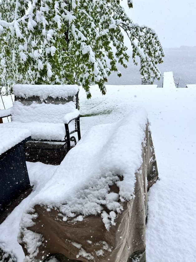
 Fresh snow that fell in Killarney on May 24, 2024. (Scott Cockbill)
"It wasn't quite clear how wide or extensive the snow would be. But I think it was mentioned in a number of the forecasts," said Hasell.
As for what this storm could bring over the next 24 hours, Hasell said it will eventually hit the southeastern part of the province and then move north, bringing more precipitation.
"It's not leaving here until sometime tomorrow, or very late tonight at the earliest. But probably in the overnight period. After midnight tonight is probably when these areas south of us are going to be out of it."
With the rain, Hasell warns of the potential of overland flooding, and notes it will be extremely windy as well. She advises people to not try and drive through any standing or moving water, as vehicles could get stuck or even swept away.
Rainfall warnings continue to be in places for areas as far west as Napinka, as far north as Jackhead, and as far east as Vita.
Multiple power outages reported in Manitoba
The snow and rain are also resulting in multiple power outages in Manitoba.
Brandon has 1,568 customers without power, according to Manitoba Hydro, while the Killarney-Turtle Mountain area is dealing with 843 customers without power. The North Norfolk area is dealing with 772 outages right now.
A full map can be viewed on Manitoba Hydro’s website.
It is not known when power will be fully restored.
CTVNews.ca Top Stories

Donald Trump says Canada becoming 51st U.S. state 'a great idea'
U.S. President-elect Donald Trump is taking aim at Canada once more, saying it would be 'a great idea' to make it America's ‘51st state.'
After scamming their victims, some con artists go on to scam our courts with impunity
Convicts, including fraudsters, are skipping out on their court-ordered payments to their victims to the tune of tens of millions of dollars across the country, according to figures obtained by CTV W5.
The barriers and benefits as a global bank looks to branch out in Canada
It's not every day, or even every decade, that a big foreign bank decides to have a go at Canada's retail banking market. But Spain's Banco Santander is poised to be among the few that have tried as it nears the all-clear to expand in Canada.
Ryan Reynolds among new appointments to Order of Canada
Ryan Reynolds, Scott Oake and Maureen Ann Jennings are among the 88 new recipients of the Order of Canada.
Canadian government announces new border security plan amid Donald Trump tariff threats
The federal government has laid out a five-pillared approach to boosting border security, though it doesn't include specifics about where and how the $1.3-billion funding package earmarked in the fall economic statement will be allocated.
Nissan, Honda confirm talks on closer collaboration but say there's been no decision on a merger
Japanese automakers Nissan Motor Corp. and Honda Motor Co. confirmed Wednesday that they are discussing closer collaboration but denied reports they have decided on a merger.
Verdicts are due in the historic French rape trial that turned Gisele Pelicot into a feminist hero
French judges plan to deliver hugely anticipated verdicts this week in a historic drugging-and-rape trial that has turned the victim, Gisele Pelicot, into a feminist hero.
2 B.C. police officers charged with sexual assault
Two officers with a Vancouver Island police department have been charged with the sexual assault of a "vulnerable" woman, authorities announced Tuesday.
B.C. teacher disciplined for refusing to let student use bathroom
A teacher who refused to let a student use the bathroom in a B.C. school has been disciplined by the province's professional regulator.


