What water levels look like along the Red River
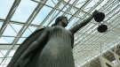
 The Red River at James Avenue
It is flood season in North Dakota and Manitoba along the Red River.
CTV News Winnipeg has created a map showing projected crest dates, levels and current water levels at major spots from Fargo, ND, to Winnipeg.
The map will be updated daily with the most recent information from the National Weather Service and the Government of Manitoba.
View the map below.
A second graph shows the gradual rise of the Red River in Manitoba, with information from Emerson up into Winnipeg.
View the graph below.
Shopping Trends
The Shopping Trends team is independent of the journalists at CTV News. We may earn a commission when you use our links to shop. Read about us.


CTVNews.ca Top Stories

Canadian government announces new border security plan amid Donald Trump tariff threats
The federal government has laid out a five-pillared approach to boosting border security, though it doesn't include specifics about where and how the $1.3-billion funding package earmarked in the fall economic statement will be allocated.
Fall sitting bookended by Liberal byelection losses ends with Trudeau government in tumult
The House of Commons adjourned on Tuesday, bringing an end to an unstable fall sitting that has been bookended by Liberal byelection losses. The conclusion of the fall sitting comes as Prime Minister Justin Trudeau's minority government is in turmoil.
Police chief says motive for Wisconsin school shooting was a 'combination of factors'
Investigators on Tuesday are focused on trying to determine a motive in a Wisconsin school shooting that left a teacher and a student dead and two other children in critical condition.
B.C. teacher disciplined for refusing to let student use bathroom
A teacher who refused to let a student use the bathroom in a B.C. school has been disciplined by the province's professional regulator.
Prosecutors charge suspect with killing UnitedHealthcare CEO as an act of terrorism
The man accused of killing UnitedHealthcare's CEO has been charged with murder as an act of terrorism, prosecutors said Tuesday as they worked to bring him to a New York court from from a Pennsylvania jail.
14 dead and hundreds injured in magnitude 7.3 quake in Vanuatu. Some people are trapped in rubble
A magnitude 7.3 earthquake that struck off Vanuatu killed at least 14 people, injured hundreds more and caused widespread damage across the South Pacific island nation, rescuers and officials said early Wednesday. Rescuers worked through the night trying to reach some people yelling under the rubble.
The world's busiest flight routes for 2024 revealed
If you think planes have got fuller and the skies busier over the past year, you’d be right — especially if you live in either Hong Kong or Taipei.
'She will not be missed': Trump on Freeland's departure from cabinet
As Canadians watched a day of considerable political turmoil for Prime Minister Justin Trudeau and his government given the sudden departure of Chrystia Freeland on Monday, it appears that U.S. president-elect Donald Trump was also watching it unfold.
She donated a kidney years ago. Last month, she received a kidney transplanted from a gene-edited pig
Towana Looney is the only person in the world living with a functional pig kidney. But her doctor predicts that in less than a decade, pig-to-human organ transplants like hers could become routine.
Regina
-

Conflict of Interest Commissioner recommends reprimand for Health Minister Jeremy Cockrill
Saskatchewan's Conflict of Interest Commissioner (COIC) is recommending a reprimand for Health Minister Jeremy Cockrill after finding he broke legislative rules when a company tied to his family participated in government contracts.
-
Riders earn passing grade in first ever player report card from CFLPA
The Saskatchewan Roughriders earned passing grades in all categories but one in the CFL Players' Association first player report card.
-
Saskatchewan art gallery hopes to find artist of pristine Tommy Douglas mural
For the last five years, the Weyburn Art Gallery have been trying to find any information relating to the artist behind a massive mural they found of Tommy Douglas.
Saskatoon
-

First Nation leaders push to close 'loophole' laws after judge stays fatal THC-impaired driving charge
The Federation of Sovereign Indigenous Nations (FSIN) wants to change the Criminal Code of Canada to prioritize victims that are children.
-
'She was fiercely competitive': Saskatoon historic Olympic medal winner honoured
One of Saskatoon’s most famous Olympians finally gets her official recognition — and it’s been almost a century in the making.
-
Conflict of Interest Commissioner recommends reprimand for Health Minister Jeremy Cockrill
Saskatchewan's Conflict of Interest Commissioner (COIC) is recommending a reprimand for Health Minister Jeremy Cockrill after finding he broke legislative rules when a company tied to his family participated in government contracts.
Edmonton
-

Smith, Ford remain at odds on tariffs despite message of unity at premiers' meeting
Alberta's premier is trying to assure Canadians – and Americans – that she has a strategy to address possible Trump tariffs.
-
Vermilion petsitter charged after dog's death
A Vermilion man has been charged after a dog died while in his care.
-
Lots of snow and some serious cold coming to Edmonton region Wednesday
Prepare for a significant dump of heavy snow Wednesday.
Calgary
-

Calgary man pleads guilty to manslaughter in 2022 shootings
A Calgary man was sentenced to 16 years in jail after pleading guilty to manslaughter in connection with two 2022 shootings.
-
Calgary police officer charged in on-duty assault in Woodbine
A Calgary police officer is facing charges after he allegedly fired a Taser at a man twice during an incident in Woodbine earlier this year.
-
'Condensed timeline' puts pressure on Calgary council to approve Green Line project
With timelines tightening, Calgary city council is asking for an urgent meeting with the Alberta government to discuss a reworked plan to build a multibillion-dollar light-rail-transit line connecting the city's southeast to downtown.
Toronto
-

Two men charged in death of Markham real estate agent as search continues for murder suspect
Two people have been charged in connection with the disappearance and death of a Markham real estate agent whose remains were found in Parry Sound over the summer.
-
Canadian government announces new border security plan amid Donald Trump tariff threats
The federal government has laid out a five-pillared approach to boosting border security, though it doesn't include specifics about where and how the $1.3-billion funding package earmarked in the fall economic statement will be allocated.
-
1 person in hospital after vehicle reportedly shot at in Etobicoke
One person is in hospital after a vehicle was reportedly shot at in Etobicoke Tuesday afternoon.
Ottawa
-

Villa Marconi, board refute union allegations about hygiene care
The chair of the board of directors at Villa Marconi, a long-term care facility on Baseline Road, says allegations around supply shortages leading to neglect of resident hygiene are "all false."
-
Ottawa Public Health warns of very low risk of hepatitis A exposure at south-end Tim Hortons
Ottawa Public Health is warning residents about a possible risk of exposure to hepatitis A at a local Tim Hortons in the city's south end.
-
'We have nowhere to go:' Brockville, Ont. woman seeking OHIP coverage for rare nerve disease
Sadie van Ravenhorst, diagnosed with Tarlov Cyst Disease, a rare neve disease, is hoping OHIP will cover her surgery.
Montreal
-

Quebec physicians ready to strike, if necessary, in early 2025
The Quebec resident physicians federation says it is ready to strike if necessary, given the impasse in its negotiations with Quebec to renew its collective agreement.
-
Culture of silence at Montreal youth detention facility at centre of sex scandal
A new report says a culture of silence reigned over a Montreal detention centre where female employees are accused of sexually abusing detainees, with at least one worker becoming pregnant.
-
Alouettes trade Grey Cup MVP Fajardo to Elks for rights to Bethel-Thompson in QB swap
Veteran quarterbacks Cody Fajardo and McLeod Bethel-Thompson are on the move again.
Atlantic
-

Snow forecast to fall in parts of the Maritimes this week
As rainy and gusty weather clears the Maritimes Tuesday, a round of snow and rain is lined up for late week.
-
Sex-ed group deemed 'inappropriate' by Tory government returns to N.B. schools
A sexual-education group whose presentations were deemed "clearly inappropriate" by the previous New Brunswick Progressive Conservative government has been cleared to return to the province's schools.
-
N.B.'s Horizon Health Network says they've 'planned far more diligently' for holiday season
With both sick and holiday seasons here, New Brunswick's Horizon Health Network say it's prepared heading into the holidays with proactive steps being taken.
Vancouver
-
 LIVE SOON
LIVE SOON 2 officers from Vancouver Island police department arrested
A Vancouver investigation led to the arrest of two officers from the Central Saanich Police Service, authorities announced Tuesday.
-
You can explore the B.C. Interior's movie locations with a new interactive map
B.C.'s reputation as Hollywood North goes well beyond Metro Vancouver, and a new online tool aims to show off one Interior region’s contributions to film history.
-
Costly prescriptions are forcing many Canadians to go without medical treatment, says study
One in 20 Canadians are opting out of continuing their medications because they can’t afford the prescription costs, new research has found.
Vancouver Island
-
LIVE SOON
LIVE SOON 2 officers from Vancouver Island police department arrested
A Vancouver investigation led to the arrest of two officers from the Central Saanich Police Service, authorities announced Tuesday.
-
Tofino Harbour Authority closed due to standoff with 'squatter,' agency says
The Tofino Harbour Authority says it has temporarily shuttered its office in the coastal Vancouver Island community due to an escalating standoff with the operator of a so-called "squatter" vessel.
-
B.C.'s projected deficit grows again to $9.4 billion in latest fiscal update
British Columbia's forecasted record deficit for this fiscal year has grown by another $429 million, reaching $9.4 billion.
Kelowna
-
B.C. man sentenced for 'execution-style' murder of bystander in drug trade conflict
A B.C. man convicted of the "intentional and ruthless killing of a bystander" while acting as an enforcer in the drug trade has been sentenced for a second time in the slaying.
-
Paramedic threatened at knifepoint inside Kelowna ambulance station, union says
The union representing ambulance paramedics in B.C. is calling on the province to beef up security after they say a knife-wielding woman attacked a worker.
-
Car stolen, fleeing suspect found hiding in basement in Kelowna, B.C.
Mounties have arrested a suspect who allegedly stole a car in Kelowna, B.C., before fleeing on foot and hiding from police in the basement of a home.
N.L.
-

After fanfare of Churchill Falls deal, Newfoundland urged to learn its dam lessons
Energy observers in Newfoundland and Labrador are urging the provincial government to take a sober second look at a massive tentative deal announced last week with Quebec that promises to deliver hundreds of billions of dollars in revenue to the Atlantic province.
-
Backhoe used to tear the front off Newfoundland bank, four facing charges: RCMP
Four people in eastern Newfoundland are facing charges after a stolen backhoe was used to tear the front off the RBC bank in Holyrood.
-
'Breaking of gridlock' between Quebec, N.L. is the envy of former premiers
Former Newfoundland and Labrador premiers say a draft energy agreement signed Thursday with Quebec marks a historic break in a long-standing political standoff.
Northern Ontario
-

Two in northern Ont. charged with manslaughter in death of a child
Two people have been charged with manslaughter and other offences in connection with the death of a seven-year-old two years ago in Hearst, Ont.
-
North Bay man charged with assault at retirement home
A North Bay man is facing criminal charges after allegedly damaging property at a retirement home and attempting to assault staff and residents.
-
W5 Investigates
W5 Investigates How a convicted con artist may have exploited Airbnb's ID checks in rental scams
In part two of a W5 investigation into landlord scams, correspondent Jon Woodward looks at how hosts on Airbnb may be kept in the dark about their guests' true identities – a situation that a prolific Canadian con artist appears to have taken advantage of.
Barrie
-

'We've been scammed,' Customers allege floating home company owner left them in limbo after payment
Several customers of a floating home company say their dream of living on the water has turned into a financial and emotional nightmare.
-
Woman arrested after officer seizes 'over a pound of meth' during traffic stop
A woman from Elmvale is accused of possessing over a pound of methamphetamine, weapons and illegal cigarettes after a traffic stop in Barrie.
-
Ontario invests $93 million to enhance air ambulance fleet in Simcoe County
Ontario is investing $93 million to expand Ornge Air Ambulance’s fleet to boost access to critical care for people in remote and northern parts of the province, with two additional high-speed, long-distance aircraft, a new hangar in Simcoe County, and more frontline staff.
Kitchener
-

Victim of Cambridge, Ont. dog attack claims same animal is up for adoption without disclosure
A Cambridge, Ont. woman who was involved in a vicious dog attack this summer claims one of the dogs involved is now up for adoption.
-
University of Waterloo says two PhD students killed in Gaza airstrike
The University of Waterloo says twin sisters, who were set to start their PhD studies at the school, were killed in an Israeli airstrike in Gaza.
-
3 suspects wanted following jewelry store robbery at Cambridge Centre Mall
Police said they were called to the shopping centre on Hespeler Road around 8:15 p.m. Monday for reports of a robbery at a jewelry store.
London
-

Two people wanted as part of London assault investigation
London police are looking for two men wanted in an assault investigation. Police say a man got out of his vehicle on Nov. 26 around 6:30 p.m. in the area of Brydges and Hale streets.
-
'We are now moving into a zero-tolerance world': Sarnia mayor reacts as councillor remains defiant
A Sarnia city councillor contends he will not stay silent. Bill Dennis remains defiant in the wake of an advisory at the start of a Sarnia City Council meeting on Monday.
-
'Record growth': St. Thomas council keeps tax increase below 4% thanks to industry boom
St. Thomas City Council has approved it’s 2025 budget, and it’s a modest 3.93 per cent increase.


