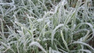
Colleen Bready's Forecast: Hot temperatures sticking around Tuesday
It will be a hot August day on Tuesday in Winnipeg and across Manitoba and northwestern Ontario.
That’s problematic for parts of northern Manitoba where temperatures are set to soar the highest amid wildfire smoke. Daytime highs are forecast to reach 30 C in several areas.
Environment and Climate Change Canada (ECCC) has continued a heat warning for the most northern regions in the province and extended it well into the northeast today, too.
ECCC has also kept an air quality alert in place for much of the north.
Expect both weather alerts to remain in effect until a cold front passes over the region Wednesday night into Thursday.
Even after the front moves through, there’s still some question about how much wildfire smoke will clear out.
Meanwhile, daytime highs in the south today are forecast to reach between 27 C and 29 C in the sunshine.
Tonight will be warm with lows in the mid to upper teens.
Western Manitoba could see some overnight showers or thunderstorms. If they show up, thunderstorms are expected to be non-severe.
There’s a good chance of showers across the west on Wednesday.
It’s not a certainty, but showers could reach Winnipeg on Wednesday night.
The chance of showers increases in the city on Thursday before sunshine and mid-to-upper 20s temperatures return Friday and through the weekend.


CTVNews.ca Top Stories

TONIGHT
TONIGHT Watch live here: The Trump-Harris 2024 presidential debate is tonight
U.S. Vice-President Kamala Harris and former president Donald Trump will meet face-to-face tonight in the ABC presidential debate. Here's how to watch the event that comes just two months before election day.
U.S. presidential historian predicts results of November elections. Here's who he says will win
An American presidential historian is predicting a Kamala Harris presidency as the outcome of the upcoming U.S. elections in November.
6 things to watch for when Kamala Harris debates Donald Trump
The fundamental question ahead of their meeting in Philadelphia, one of the highest-stakes national debates in a generation, is whether – and how – the presidential candidates can deliver a compelling message.
Canadians want to tip 15% at restaurants, don't want to tip for takeout, survey says
Despite what the default options on the payment terminal might read, most Canadians still want to tip around 15 per cent, according to a new survey.
PwC plans to track employees' location while at work. Is this practice legal in Canada?
As PricewaterhouseCoopers plans to enforce its back-to-office policy by tracking employees in the U.K., one employment lawyer explains whether the practice is legal in Canada.
Terror suspect entered Canada with student visa in June 2023, immigration minister confirms
A Pakistani citizen who was arrested last week in Quebec and charged with plotting a terrorist attack in New York City came to Canada on a student visa in June 2023, Immigration Minister Marc Miller has confirmed.
'A decisive time': Mark Carney calls new role 'an honour,' dodges questions about running for office
In his first press conference on the job, newly appointed Liberal economic growth task force chair Mark Carney said it's 'an honour' to serve in his new role, but wouldn't say whether he plans to run for political office, or whether he'll recommend changing the controversial carbon tax.
Joly says Canada bars any Canadian-made arms from reaching Gaza
Canadian-made weapons will be prohibited from reaching the Gaza Strip, Foreign Affairs Minister Melanie Joly said Tuesday.
NDP MPs embrace distance from 'radioactive' Trudeau brand, as Singh convenes caucus in Montreal
Just days after demolishing his deal with Justin Trudeau’s Liberals, NDP Leader Jagmeet Singh is holding a three-day strategy session with his MPs in Montreal. There, his MPs are embracing their new-found distance from what one called Prime Minister Justin Trudeau's 'radioactive' brand.
Shopping Trends
The Shopping Trends team is independent of the journalists at CTV News. We may earn a commission when you use our links to shop. Read about us.


Regina
-

Regina retirement community evacuated, fire crews respond
A retirement community in southwest Regina was evacuated after a small fire was reported in the facility's basement.
-
Saskatchewan NDP promises rental protections ahead of looming fall election
The Saskatchewan NDP is promising help with high rents as it gears up for the October general election.
-
Here's how many tornadoes touched down in Sask. in 2024
With the arrival of September and more fall-like weather patterns – the likelihood of Saskatchewan seeing any more tornadoes this year is next to nothing.
Saskatoon
-

Buyers say they lost life savings to a Saskatchewan company selling luxury vacation condos
In 2022, Tanya Frisk-Welburn and her husband bought what they hoped would be a dream home in Mexico.
-
Preparations are underway for Saskatoon's civic election
The City of Saskatoon is making its final preparations ahead of November's civic election.
-
Here's how many tornadoes touched down in Sask. in 2024
With the arrival of September and more fall-like weather patterns – the likelihood of Saskatchewan seeing any more tornadoes this year is next to nothing.
Edmonton
-

Alberta premier Smith defends sharing public policy plans at members-only UCP events
Premier Danielle Smith is defending making a string of policy announcements at private United Conservative Party events, saying Albertans shouldn't be surprised by her agenda.
-
TONIGHT
TONIGHT Watch live here: The Trump-Harris 2024 presidential debate is tonight
U.S. Vice-President Kamala Harris and former president Donald Trump will meet face-to-face tonight in the ABC presidential debate. Here's how to watch the event that comes just two months before election day.
-
Jasper council hears providing temporary housing for all without homes not possible
Town council in Jasper, Alta., heard Tuesday it won't be possible to secure temporary housing for everyone who lost their homes in a devastating wildfire in July.
Calgary
-
 BREAKING
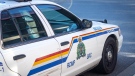
BREAKING Girl, 14, dies in crash north of Lethbridge: RCMP
A 14-year-old girl died in a crash north of Lethbridge on Tuesday morning.
-
Movie filming to close downtown Calgary road this weekend
A section of road will be closed in downtown Calgary this weekend for filming.
-
Province committed to Calgary Green Line LRT project with 'above-ground' plan
Alberta's premier has reaffirmed her commitment to Calgary’s Green Line LRT as long as the project matches the province’s new above-ground vision.
Toronto
-

Man taken to hospital after stabbing on TTC streetcar in downtown Toronto
A man has been seriously injured in a stabbing on a TTC streetcar in downtown Toronto.
-
Operators of Revue Cinema reach new five-year deal with owners
The group which runs the historical Revue Cinema in Roncesvalles Village will be sticking around to manage the theatre after reaching a new agreement with the owners.
-
TONIGHT
TONIGHT Watch live here: The Trump-Harris 2024 presidential debate is tonight
U.S. Vice-President Kamala Harris and former president Donald Trump will meet face-to-face tonight in the ABC presidential debate. Here's how to watch the event that comes just two months before election day.
Ottawa
-

Ottawa speed camera revenues going into road safety improvements at critical intersections
The City of Ottawa's automated speed enforcement (ASE) cameras continue to generate millions of dollars in revenue, and while some argue the cameras are merely revenue-generating tools, city officials insist the funds are being used exclusively for infrastructure improvements to make roads safer for all users, including pedestrians and cyclists.
-
Itinerary nightmare: Ontario couple’s trip to Italy includes five flights, via Ontario, California
An Ottawa woman says a travel agent's mistake thinking they were booking a trip from Ontario, California, and not Canada's capital, will force them to take a lengthy detour with a four-and-a-half-hour drive and five flights through Georgia and California to get to Venice, Italy for vacation.
-
Lawsuit alleges Ottawa police wiretapped, surveilled five Black officers of Somali descent
A $2.5 million lawsuit alleges Ottawa police wiretapped and surveilled five of its own Black, Somali officers, hasn't told them why and accuses the service of being an institution 'rife with racism and discrimination that over-polices the racialized communities it has pledged to protect.'
Montreal
-

Nearly half of Canadians want federal election after NDP-Liberal agreement ends, poll suggests
Following the announcement of the end of the NDP-Liberal confidence and supply agreement, a new national survey reveals that 47 per cent of Canadians would support calling a federal election to be called, while only 34 per cent would prefer not to.
-
Family of murdered Quebec police sergeant pleased with coroner's investigation
The family of a Quebec provincial police sergeant who was stabbed to death by a mentally ill man who wasn't taking his medication says it welcomes the coroner's report into her brutal murder.
-
Pro-Palestinian activists charged with harassment while protesting Marc Miller
The lawyer representing pro-Palestinian activists accused of criminal harassment toward federal Immigration Minister Marc Miller says the charges are an attempt to "criminalize free speech."
Atlantic
-
Frost Advisories issued in New Brunswick; Tropical Storm Francine update
Some parts of New Brunswick have Frost Advisories in effect.
-
RCMP investigating suspicious disappearance of Nova Scotia woman
The Nova Scotia RCMP is investigating the suspicious disappearance of a 55-year-old woman.
-
'I’m so proud that we could do 100 years': Family-owned business marks major milestone in menswear
Mansour’s Menswear in Amherst, N.S., is celebrating its 100th anniversary this month
Vancouver
-

$2M home belonging to children's musician Raffi on the market
Canada’s children’s troubadour is selling his B.C. home, which is now up for grabs for $1,995,000.
-
'Patently unreasonable': Order for tenants to pay $18K for leaks overturned by B.C. judge
An arbitrator's decision ordering two renters to cover more than $18,000 in repairs following a water leak at their landlord's home was "patently unreasonable," a B.C. Supreme Court judge has ruled.
-
TONIGHT
TONIGHT Watch live here: The Trump-Harris 2024 presidential debate is tonight
U.S. Vice-President Kamala Harris and former president Donald Trump will meet face-to-face tonight in the ABC presidential debate. Here's how to watch the event that comes just two months before election day.
Vancouver Island
-
$2M home belonging to children's musician Raffi on the market
Canada’s children’s troubadour is selling his B.C. home, which is now up for grabs for $1,995,000.
-
B.C. man allowed to keep Great Dane in condo where pets prohibited: tribunal
A B.C. man has won his fight to keep a Great Dane in his condo – despite the building’s ban on pets.
-
TONIGHT
TONIGHT Watch live here: The Trump-Harris 2024 presidential debate is tonight
U.S. Vice-President Kamala Harris and former president Donald Trump will meet face-to-face tonight in the ABC presidential debate. Here's how to watch the event that comes just two months before election day.
Kelowna
-
Woman stabbed during daylight Kelowna home invasion: RCMP
A woman suffered life-threatening injuries after being stabbed during a home invasion in Kelowna, according to authorities.
-
Dog mauled to death in B.C. yard after 3 pit bulls jump fence: police
A 12-year-old collie was killed by three pit bulls in the B.C. Interior Sunday morning, according to authorities.
-
Suspect charged with 2nd-degree murder 1 year after Smithers, B.C., shooting
Mounties in northwestern B.C. say they have arrested the suspect in a fatal shooting almost exactly a year after it occurred.
N.L.
-

Newfoundland and Labrador monitoring rise in whooping cough cases: medical officer
Newfoundland and Labrador's chief medical officer is monitoring the rise of whooping cough infections across the province as cases of the highly contagious disease continue to grow across Canada.
-
Dispute over unrecognized Inuit group halts major conference for Canadian North
A 16-year-old biennial event aimed at fostering business in the country's eastern Arctic and northern regions has been cancelled indefinitely as a dispute unfolds between Inuit in Canada and a Labrador group claiming to share their heritage.
-
Cow cuddling: Why a Newfoundland farm is offering quality time with these 'gentle creatures'
Jim Lester’s farm hopped on the cow-cuddling trend in early August, and his time slots have been pretty well sold out ever since.
Northern Ontario
-

Terror suspect entered Canada with student visa in June 2023, immigration minister confirms
A Pakistani citizen who was arrested last week in Quebec and charged with plotting a terrorist attack in New York City came to Canada on a student visa in June 2023, Immigration Minister Marc Miller has confirmed.
-
Meagan Pilon's family just wants to know what happened to her
As the 11th anniversary of her disappearance approaches, the family of missing Sudbury teen Meagan Pilon say they just want to know what happened to her.
-
Bears in schoolyard force students and staff into 2nd hold and secure this week
A Huntsville elementary school is locked down for the second time this week because of some bears roaming the schoolyard.
Barrie
-

'There was a lot of blood,' Forensic evidence presented in 1994 Katherine Janeiro murder trial
Forensic evidence collected nearly 30 years ago was a key focus in court Tuesday during the trial of Bruce Ellis, also known as Robert MacQueen, who is charged with the 1994 murder of Katherine Janeiro.
-
Bears in schoolyard force students and staff into 2nd hold and secure this week
A Huntsville elementary school is locked down for the second time this week because of some bears roaming the schoolyard.
-
One person dies in multi-vehicle collision in Bolton
Emergency crews responded to a multi-vehicle collision in Bolton Tuesday morning that claimed the life of one person.
Kitchener
-

What you need to know about rabies and how to protect against infection
Health officials are urging the public to take certain precautions to reduce their risk of getting rabies.
-
Security video released of Kitchener gas station robbery
Police have released security video from an armed robbery at a Kitchener gas station.
-
Interpol warns OPP of social media threat to Haldimand school
Ontario Provincial Police say they received a tip about a threat to a Haldimand County school from Interpol at around 4 a.m. Tuesday.
London
-

Could Budweiser Gardens be getting a new name?
Canada Life and Oak View Group have jointly submitted a proposal to London City Council to rename Budweiser Gardens, the 10,000-seat multi-purpose sports and entertainment venue, to ‘Canada Life Place.’
-
TVDSB names interim director of education
The Thames Valley District School Board (TVDSB) has named an interim Director of Education. The Board of Trustees has named Bill Tucker to the position, effective immediately, following the news that Mark Fisher would be taking a leave.
-
TONIGHT
TONIGHT Watch live here: The Trump-Harris 2024 presidential debate is tonight
U.S. Vice-President Kamala Harris and former president Donald Trump will meet face-to-face tonight in the ABC presidential debate. Here's how to watch the event that comes just two months before election day.


