Colleen Bready's Forecast: Hot, humid and hazy
It is a hot, humid, and hazy start to the week on Monday in Winnipeg and most of Manitoba.
Most of the province will see either sunshine or a mix of sun and cloud this afternoon.
Temperatures in Winnipeg and the southeast will reach the upper 20s. Look for highs up to 30 C in parts of the southwest including Brandon.
In the northwest, daytime highs will climb to the mid-20s. The northeast will be cooler with highs in the low 20s.
Late this morning, Environment and Climate Change Canada (ECCC) reinstated an air quality alert for some northwest regions near Saskatchewan including Lynn Lake.
Those areas will have to deal with another round of widespread wildfire smoke today.
After smoke in the south on the weekend, conditions will be hazy here today and tonight.
Otherwise, expect a quiet night ahead in the south with light winds and overnight lows in the mid-teens.
However, humidity will remain high enough that fog could develop over the next few nights. That could reduce visibility if you have an overnight or early morning commute.
The heat continues on Tuesday and Wednesday in Winnipeg.
Rain is also brewing this week. An upper trough of low pressure well to the west of us now will bring rain showers by Wednesday night.
Rain showers will continue on Thursday with cooler temperatures.
Heat and sunshine return by Friday and the weekend.


CTVNews.ca Top Stories

Walking pneumonia is surging in Canada. Is it peaking now?
CTVNews.ca spoke with various medical experts to find out the latest situation with the typically mild walking pneumonia in their area and whether parents should be worried.
Minister calls GST holiday, $250 cheques for 18 million Canadians 'a targeted approach'
Women and Gender Equality and Youth Minister Marci Ien is calling the federal government's proposed GST holiday and $250 rebate cheques a 'targeted approach' to address affordability concerns.
'Her shoe got sucked into the escalator': Toronto family warns of potential risk of wearing Crocs
A Toronto family is speaking out after their 10-year-old daughter's Crocs got stuck in an escalator, ripping the entire toe area of the clog off.
Prime Minister Trudeau attends Taylor Swift's Eras Tour in Toronto with family
Prime Minister Justin Trudeau is a Swiftie. His office confirmed to CTV News Toronto that he and members of his family are attending the penultimate show of Taylor Swift's 'The Eras Tour' in Toronto on Friday evening.
NEW
NEW Thinking about taking an 'adult gap year'? Here's what experts say you should know
Canadian employees are developing an appetite for an 'adult gap year': a meaningful break later in life to refocus, refresh and indulge in something outside their daily routine, according to experts.
Canada's tax relief plan: Who gets a cheque?
The Canadian government has unveiled its plans for a sweeping GST/HST pause on select items during the holiday period. The day after the announcement, questions remain on how the whole thing will work.
Colleges and universities face job cuts, deficits amid international student cap
Ontario's colleges and universities say the federal government's cap on international students is taking a toll on the higher education sector as some schools face growing deficits, layoffs and, in at least one case, a temporary campus closure.
The Thriftmas Special: The benefits of second-hand holiday shopping
The holidays may be a time for family, joy and togetherness, but they can also be hard on the wallet.
The Philippine vice president publicly threatens to have the president assassinated
Philippine Vice President Sara Duterte said Saturday she has contracted an assassin to kill the president, his wife and the House of Representatives speaker if she herself is killed, in a brazen public threat that she warned was not a joke.
Shopping Trends
The Shopping Trends team is independent of the journalists at CTV News. We may earn a commission when you use our links to shop. Read about us.


Regina
-

Ministry of Highways releases annual snow campaign as Sask. braces for more snow
Snowplows will be on standby ready to go as the province is expected to get more snow over the weekend.
-
Chiropractor accused of sexually assaulting 7 women denies all allegations as part of second day of testimony
Ruben Manz, a Regina-based chiropractor accused of sexually assaulting seven women from 2010 through 2021, denied ever touching any of the alleged victims in a sexual nature while under oath.
-
Here's a look inside the Globe Theatre before it reopens
The format is the same, but the venue looks very different from the last time audiences were inside Regina's Globe Theatre after extensive renovations.
Saskatoon
-

Why isn't Saskatoon's new downtown shelter open yet?
Saskatoon's new downtown shelter must undergo renovations before it can open, according to the operator of the site.
-
Sask. principal has sexual assault conviction overturned in light of 'butt-grabbing game'
A Saskatchewan principal sentenced to six months behind bars for sexual assault has another chance to prove he’s the victim of a middle-school prank that escalated out of control.
-
Prince Albert food bank faces soaring demand
The Prince Albert Food Bank is grappling with a significant surge in demand, with the number of hampers doubling since 2017.
Edmonton
-

Man armed with knife arrested in west Edmonton: EPS
A man armed with a knife was arrested in west Edmonton Friday afternoon, police said.
-
Santas, sports and shows: Here's what's happening in Edmonton this weekend
If you want to get out and enjoy the weather, or get inside and warm up, there's plenty to do in and around Edmonton this weekend.
-
Drake's clothing brand launches NHL collection including Oilers merch
Drake's October's Very Own (OVO) clothing has launched an NHL collection.
Calgary
-

'Sounded like a bomb': Mahogany residents stunned by townhouse explosion, fire
Investigators are working to piece together what caused an explosion and fire at a six-plex in the southeast Calgary community of Mahogany.
-
Budget adjustments passed by Calgary city council; property taxes to go up 3.6 per cent in 2025
Calgary city council passed its mid-cycle budget adjustments on Friday evening, following a long week of debate. The budget was passed with a vote of 9-6.
-
‘Pinch me I’m dreaming:’ Calgary drummer pulled from crowd to play with the Arkells
For young musicians, to be up on stage in front of thousands of people, would be a dream come true. That’s exactly what happened to a Calgary girl, after being invited to play with Canadian rock icons The Arkells.
Toronto
-

'Still working full time on it:' One year later police continue to search for gunman in Caledon double murder linked to ex-Olympian
One year after a couple was shot and killed in their Caledon home in what investigators have described as a case of mistaken identity, Ontario Provincial Police say they are still trying to figure out who pulled the trigger.
-
Colleges and universities face job cuts, deficits amid international student cap
Ontario's colleges and universities say the federal government's cap on international students is taking a toll on the higher education sector as some schools face growing deficits, layoffs and, in at least one case, a temporary campus closure.
-
Shooting in East End Toronto sends one to hospital: TPS
A man has been sent to hospital after being located in Toronto’s east-end with gunshot wounds.
Ottawa
-
 NEW THIS MORNING
NEW THIS MORNING 290,000 speeding tickets and counting: A look at how many photo radar tickets have been issued in Ottawa in 2024
Photo radar cameras have caught nearly 300,000 speeders on Ottawa roads so far this year, as the City of Ottawa prepares to expand the automated speed enforcement camera program to another 39 locations over the next 14 months.
-
Seniors facing 60% hike for OC Transpo monthly transit pass in 2025 under new proposal
Ottawa seniors will be facing a 60 per cent hike in transit fares in 2025, instead of a 120 per cent increase, under a new plan to halve a proposed hike in fares for riders over the age of 65.
-
Ottawa Food Bank declares an emergency amid record-breaking usage
The Ottawa Food Bank is calling the record-breaking visits to its food programs "a declaration of emergency," with children and youth and newcomers accounting for more than a quarter of visits last year.
Montreal
-

3 arrested at pro-Palestinian, anti-NATO protest downtown Montreal
As NATO officials met up in Montreal, pro-Palestinian protesters flooded downtown in solidarity with those in Gaza.
-
Quebec man, 81, gets prison sentence after admitting to killing wife with Alzheimer's disease
An 81-year-old Quebec man has been sentenced to prison after admitting to killing his wife with Alzheimer's disease.
-
Montreal family doctor admits to fathering child with 19-year-old patient
A Montreal family doctor has vowed to stop practicing medicine after he admitted to fathering a child with a 19-year-old woman who was his patient.
Atlantic
-

P.E.I. teen sentenced to 2 years in custody in death of Tyson MacDonald
A teen who pleaded guilty in the death of 17-year-old Tyson MacDonald on Prince Edward Island last year has been sentenced to two years in custody.
-
Taylor Swift Fan brings souvenir home to Nova Scotia from the Eras tour
Annie Gallant, a 10-year-old from Nova Scotia, brought home a special gift from her first concert.
-
Walking pneumonia is surging in Canada. Is it peaking now?
CTVNews.ca spoke with various medical experts to find out the latest situation with the typically mild walking pneumonia in their area and whether parents should be worried.
Vancouver
-

SPS one week away from taking over Surrey policing
It’s been a long and drawn out process, but we are now a week away from Surrey’s new municipal force formally taking over policing responsibility in that city.
-
Abbotsford residents fed up with noise from provincial project so loud it 'shakes the house'
Residents of a rural Abbotsford neighbourhood are fed up with the noise from a provincial project that has meant hundreds of dump trucks rumbling up and down their street in the middle of the night.
-
Jodi Henrickson’s ex-boyfriend Gavin Arnott charged with assaulting woman in Alta.
The ex-boyfriend of missing B.C. teenager Jodi Henrickson was recently charged with assaulting a woman in Alberta, but the charges were withdrawn due to an unco-operative witness, CTV News has learned.
Vancouver Island
-
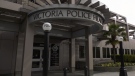
Victoria police face being understaffed amid proposed budget cuts
Layoffs could be imminent for the Victoria Police Department if it adheres to the requests of the City of Victoria, and cuts over $2 million from its budget.
-
Campbell River high school closure extended due to fire
Carihi Secondary school in Campbell River is closed due to a fire on the property overnight – drawing a firefighting response from multiple departments and a crowd of onlookers.
-
Grey Cup streaker fined $10K, banned from BC Place
The woman who ran across the field wearing nothing but her shoes at last weekend’s Grey Cup has been given a fine and banned from BC Place.
Kelowna
-

Man in hospital following targeted shooting in Kamloops
Police are appealing for information on a targeted shooting that resulted in the hospitalization of a man in Kamloops.
-
Police cleared of fault in fatal 2023 crash in B.C.'s Interior
British Columbia's independent police watchdog has cleared officers of wrongdoing in a crash where three people were killed south of Kamloops in July of last year.
-
B.C. woman sentenced for stealing $14K in funds raised for schoolkids
A B.C. woman who stole more than $14,000 in volunteer-raised funds that were supposed to be spent on school supplies and programs – including hot meals for vulnerable kids – won't spend any time in jail.
N.L.
-

As N.L. firm pivots, scientists say Canada's green hydrogen dreams are far-fetched
A Newfoundland energy company's embrace of data centres is raising doubts about eastern Canadian hopes of harnessing the region's howling winds to supply Germany with power from green hydrogen.
-
Canadian leads group pushing Vatican for zero-tolerance policy on abuse by clergy
An international group led by a Canadian is in Rome this week to push the Catholic Church to adopt a zero-tolerance policy on abuse by clergy.
-
Newfoundland wind-to-hydrogen company eyes data centre as international market lags
A company hoping to build a multi-billion-dollar wind-to-hydrogen project in western Newfoundland is eyeing other options as Canada's plans to supply Europe with green energy have not yet materialized.
Northern Ontario
-

Senior killed in dog attack in northern Ont.
An 81-year-old was killed in a dog attack this week in Bonfield, Ont. Police believe three dogs were involved.
-
Woman stabbed multiple times in Sudbury altercation
A 30-year-old woman is in hospital in Sudbury after she was stabbed multiple times early Friday morning in Chelmsford.
-
Police investigating death in Magnetawan, Ont.
The Almaguin Highlands detachment of the Ontario Provincial Police is investigating a sudden death in Magnetawan.
Barrie
-

Highway 400 closed in Muskoka Lakes after fatal propane truck rollover
Emergency crews were called to Highway 400 in Georgian Bay Township Friday morning after a fatal tanker truck rollover.
-
Drug trafficking investigation results in largest fentanyl seizure in Simcoe County: OPP
Two people are facing drug trafficking charges after what provincial police are calling the largest fentanyl seizure in Simcoe County.
-
Barrie magic mushroom dispensary closed after company announces its shuttering Ont. locations
The doors are locked and the OPEN sign is off on Friday at an illegal magic mushroom dispensary in downtown Barrie one day after FunGuyz announced it would shutter its 30 Ontario locations.
Kitchener
-

Advocates push for anti-renoviction bylaws as Waterloo Region reports affordable housing progress
On National Housing Day, housing advocacy group ACORN continued to push for anti-renoviction bylaws.
-
Man charged in Kitchener crash involving Grand River Transit LRT
Charges were laid after a crash between an LRT train and a Dodge vehicle shut down a busy Kitchener street for more than eight hours on Thursday.
-
How University of Waterloo researchers could help charge your devices by moving your body
Imagine being able to charge your devices through your body’s movements.
London
-

Nuclear operator helps fund affordable housing project in Goderich
The operators of the Bruce Nuclear Plant near Kincardine just donated $1 million towards Huron County’s largest affordable housing project in years.
-
Wingham area raises $3.6 million for new CT scanner
Wingham will be getting its first ever CT Scanner thanks to a multimillion dollar fundraising campaign that just came to a close.
-
Next week’s weather will put the 'brr' in November
We’re off to a damp start this weekend, “Cloudy conditions to kick off your Saturday with the chance of rainfall first thing in the morning [due to] lake effect showers,” said CTV London Meteorologist Julie Atchison. “Over the next 36 hours we will see the chance for showers lingering.”


