Colleen Bready's Forecast: Temperatures soaring ahead of Halloween
It’s hard to believe Halloween is only days away with Monday’s soaring temperatures in Winnipeg and across southern Manitoba.
Daytime highs will climb into the mid-teens courtesy of a warm front over the region today.
Winnipeg is forecast to reach a balmy 14 C. For perspective, the normal daytime is now just 5 C.
Most areas will also enjoy sunshine or a mix of sun and cloud. Perhaps less enjoyable will be strong and gusting winds.
Conditions are similar in northwestern Ontario.
The warm front is associated with a low over Saskatchewan that is heading east.
As the low approaches, it will spread rain and snow across parts of northern Manitoba today and tonight.
Areas further south, including Thompson, will see showers this afternoon. Regions further north will get a mix of rain and snow or outright snow.
As much as 5-10 cm of snowfall is possible.
Freezing rain is possible along the transition zone that’s expected to stretch approximately from Lynn Lake to Churchill.
That all said, temperatures are still relatively warm in the north, so precipitation accumulations will likely be low.
Tonight, clouds will build up first in the southwest before moving into the southeast before morning.
Tuesday will be cloudy and cooler in Winnipeg, but temperatures will still be above seasonal by a handful of degrees.
Sunshine and more seasonable temperatures return by the midweek.
Ghosts and goblins will want to dress warmly under their Halloween costumes. The forecast daytime high on Thursday is 5 C under a mix of sun and cloud, but as the sun sets during prime time trick or treating hours, temperatures will cool off quickly.


CTVNews.ca Top Stories

Quebec man, 81, gets prison sentence after admitting to killing wife with Alzheimer's disease
An 81-year-old Quebec man has been sentenced to prison after admitting to killing his wife with Alzheimer's disease.
Canada Post quarterly loss tops $300M as strike hits second week -- and rivals step in
Canada Post saw hundreds of millions of dollars drain out of its coffers last quarter, due largely to its dwindling share of the parcels market, while an ongoing strike continues to batter its bottom line.
'Immoral depravity': Two men convicted in case of frozen migrant family in Manitoba
A jury has found two men guilty on human smuggling charges in a case where a family from India froze to death in Manitoba while trying to walk across the Canada-U.S. border.
Prime Minister Trudeau attends Taylor Swift's Eras Tour in Toronto with family
Prime Minister Justin Trudeau is a Swiftie. His office confirmed to CTV News Toronto that he and members of his family are attending the penultimate show of Taylor Swift's 'The Eras Tour' in Toronto on Friday evening.
Trump supporters review-bomb B.C. floral shop by accident
A small business owner from B.C.'s Fraser Valley is speaking out after being review-bombed by confused supporters of U.S. president-elect Donald Trump this week.
Pat King found guilty of mischief for role in 'Freedom Convoy'
Pat King, one of the most prominent figures of the 2022 'Freedom Convoy' in Ottawa, has been found guilty on five counts including mischief and disobeying a court order.
Nearly 46,000 electric vehicles recalled in Canada over power loss risk
Nearly 46,000 electric vehicles from Kia, Hyundai and Genesis are being recalled in Canada over a potential power loss issue that can increase the risk of a crash.
Trump chooses Bessent to be Treasury secretary and Vought as top budget official
President-elect Donald Trump announced Friday that he'll nominate hedge fund manager Scott Bessent, an advocate for deficit reduction, to serve as his next treasury secretary. Trump also said he would nominate Russel Vought to lead the Office of Management and Budget.
Canada's tax relief plan: Who gets a cheque?
The Canadian government has unveiled its plans for a sweeping GST/HST pause on select items during the holiday period. The day after the announcement, questions remain on how the whole thing will work.
Shopping Trends
The Shopping Trends team is independent of the journalists at CTV News. We may earn a commission when you use our links to shop. Read about us.


Regina
-

Ministry of Highways releases annual snow campaign as Sask. braces for more snow
Snowplows will be on standby ready to go as the province is expected to get more snow over the weekend.
-
Chiropractor accused of sexually assaulting 7 women denies all allegations as part of second day of testimony
Ruben Manz, a Regina-based chiropractor accused of sexually assaulting seven women from 2010 through 2021, denied ever touching any of the alleged victims in a sexual nature while under oath.
-
Here's a look inside the Globe Theatre before it reopens
The format is the same, but the venue looks very different from the last time audiences were inside Regina's Globe Theatre after extensive renovations.
Saskatoon
-

Why isn't Saskatoon's new downtown shelter open yet?
Saskatoon's new downtown shelter must undergo renovations before it can open, according to the operator of the site.
-
Sask. principal has sexual assault conviction overturned in light of 'butt-grabbing game'
A Saskatchewan principal sentenced to six months behind bars for sexual assault has another chance to prove he’s the victim of a middle-school prank that escalated out of control.
-
Prince Albert food bank faces soaring demand
The Prince Albert Food Bank is grappling with a significant surge in demand, with the number of hampers doubling since 2017.
Edmonton
-

Man armed with knife arrested in west Edmonton: EPS
A man armed with a knife was arrested in west Edmonton Friday afternoon, police said.
-
Santas, sports and shows: Here's what's happening in Edmonton this weekend
If you want to get out and enjoy the weather, or get inside and warm up, there's plenty to do in and around Edmonton this weekend.
-
Drake's clothing brand launches NHL collection including Oilers merch
Drake's October's Very Own (OVO) clothing has launched an NHL collection.
Calgary
-

'Sounded like a bomb': Mahogany residents stunned by townhouse explosion, fire
Investigators are working to piece together what caused an explosion and fire at a six-plex in the southeast Calgary community of Mahogany.
-
Budget adjustments passed by Calgary city council; property taxes to go up 3.6 per cent in 2025
Calgary city council passed its mid-cycle budget adjustments on Friday evening, following a long week of debate. The budget was passed with a vote of 9-6.
-
‘Pinch me I’m dreaming:’ Calgary drummer pulled from crowd to play with the Arkells
For young musicians, to be up on stage in front of thousands of people, would be a dream come true. That’s exactly what happened to a Calgary girl, after being invited to play with Canadian rock icons The Arkells.
Toronto
-

Man charged with murder in stabbing death of father in Scarborough
A 32-year-old man has been charged with murder in connection with the stabbing death of his father in Scarborough on Wednesday.
-
Prime Minister Trudeau attends Taylor Swift's Eras Tour in Toronto with family
Prime Minister Justin Trudeau is a Swiftie. His office confirmed to CTV News Toronto that he and members of his family are attending the penultimate show of Taylor Swift's 'The Eras Tour' in Toronto on Friday evening.
-
3 charged in connection with collision between TTC bus and stolen BMW that injured 9
Three people are facing charges in connection with a carjacking of a stolen BMW that collided with a TTC bus in North York early Monday morning.
Ottawa
-
 NEW THIS MORNING
NEW THIS MORNING 290,000 speeding tickets and counting: A look at how many photo radar tickets have been issued in Ottawa in 2024
Photo radar cameras have caught nearly 300,000 speeders on Ottawa roads so far this year, as the City of Ottawa prepares to expand the automated speed enforcement camera program to another 39 locations over the next 14 months.
-
Seniors facing 60% hike for OC Transpo monthly transit pass in 2025 under new proposal
Ottawa seniors will be facing a 60 per cent hike in transit fares in 2025, instead of a 120 per cent increase, under a new plan to halve a proposed hike in fares for riders over the age of 65.
-
Ottawa Food Bank declares an emergency amid record-breaking usage
The Ottawa Food Bank is calling the record-breaking visits to its food programs "a declaration of emergency," with children and youth and newcomers accounting for more than a quarter of visits last year.
Montreal
-

3 arrested at pro-Palestinian, anti-NATO protest downtown Montreal
As NATO officials met up in Montreal, pro-Palestinian protesters flooded downtown in solidarity with those in Gaza.
-
Quebec man, 81, gets prison sentence after admitting to killing wife with Alzheimer's disease
An 81-year-old Quebec man has been sentenced to prison after admitting to killing his wife with Alzheimer's disease.
-
Montreal family doctor admits to fathering child with 19-year-old patient
A Montreal family doctor has vowed to stop practicing medicine after he admitted to fathering a child with a 19-year-old woman who was his patient.
Atlantic
-

P.E.I. teen sentenced to 2 years in custody in death of Tyson MacDonald
A teen who pleaded guilty in the death of 17-year-old Tyson MacDonald on Prince Edward Island last year has been sentenced to two years in custody.
-
Taylor Swift Fan brings souvenir home to Nova Scotia from the Eras tour
Annie Gallant, a 10-year-old from Nova Scotia, brought home a special gift from her first concert.
-
New Brunswick government re-evaluates construction of $66-million jail in Grand Lake
The New Brunswick Liberal government says construction of a new $66-million jail in Grand Lake is under review, and could possibly be cancelled.
Vancouver
-

SPS one week away from taking over Surrey policing
It’s been a long and drawn out process, but we are now a week away from Surrey’s new municipal force formally taking over policing responsibility in that city.
-
Abbotsford residents fed up with noise from provincial project so loud it 'shakes the house'
Residents of a rural Abbotsford neighbourhood are fed up with the noise from a provincial project that has meant hundreds of dump trucks rumbling up and down their street in the middle of the night.
-
Jodi Henrickson’s ex-boyfriend Gavin Arnott charged with assaulting woman in Alta.
The ex-boyfriend of missing B.C. teenager Jodi Henrickson was recently charged with assaulting a woman in Alberta, but the charges were withdrawn due to an unco-operative witness, CTV News has learned.
Vancouver Island
-
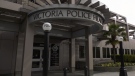
Victoria police face being understaffed amid proposed budget cuts
Layoffs could be imminent for the Victoria Police Department if it adheres to the requests of the City of Victoria, and cuts over $2 million from its budget.
-
Campbell River high school closure extended due to fire
Carihi Secondary school in Campbell River is closed due to a fire on the property overnight – drawing a firefighting response from multiple departments and a crowd of onlookers.
-
Grey Cup streaker fined $10K, banned from BC Place
The woman who ran across the field wearing nothing but her shoes at last weekend’s Grey Cup has been given a fine and banned from BC Place.
Kelowna
-

Man in hospital following targeted shooting in Kamloops
Police are appealing for information on a targeted shooting that resulted in the hospitalization of a man in Kamloops.
-
Police cleared of fault in fatal 2023 crash in B.C.'s Interior
British Columbia's independent police watchdog has cleared officers of wrongdoing in a crash where three people were killed south of Kamloops in July of last year.
-
B.C. woman sentenced for stealing $14K in funds raised for schoolkids
A B.C. woman who stole more than $14,000 in volunteer-raised funds that were supposed to be spent on school supplies and programs – including hot meals for vulnerable kids – won't spend any time in jail.
N.L.
-

As N.L. firm pivots, scientists say Canada's green hydrogen dreams are far-fetched
A Newfoundland energy company's embrace of data centres is raising doubts about eastern Canadian hopes of harnessing the region's howling winds to supply Germany with power from green hydrogen.
-
Canadian leads group pushing Vatican for zero-tolerance policy on abuse by clergy
An international group led by a Canadian is in Rome this week to push the Catholic Church to adopt a zero-tolerance policy on abuse by clergy.
-
Newfoundland wind-to-hydrogen company eyes data centre as international market lags
A company hoping to build a multi-billion-dollar wind-to-hydrogen project in western Newfoundland is eyeing other options as Canada's plans to supply Europe with green energy have not yet materialized.
Northern Ontario
-

Senior killed in dog attack in northern Ont.
An 81-year-old was killed in a dog attack this week in Bonfield, Ont. Police believe three dogs were involved.
-
Woman stabbed multiple times in Sudbury altercation
A 30-year-old woman is in hospital in Sudbury after she was stabbed multiple times early Friday morning in Chelmsford.
-
Police investigating death in Magnetawan, Ont.
The Almaguin Highlands detachment of the Ontario Provincial Police is investigating a sudden death in Magnetawan.
Barrie
-

Highway 400 closed in Muskoka Lakes after fatal propane truck rollover
Emergency crews were called to Highway 400 in Georgian Bay Township Friday morning after a fatal tanker truck rollover.
-
Drug trafficking investigation results in largest fentanyl seizure in Simcoe County: OPP
Two people are facing drug trafficking charges after what provincial police are calling the largest fentanyl seizure in Simcoe County.
-
Barrie magic mushroom dispensary closed after company announces its shuttering Ont. locations
The doors are locked and the OPEN sign is off on Friday at an illegal magic mushroom dispensary in downtown Barrie one day after FunGuyz announced it would shutter its 30 Ontario locations.
Kitchener
-

Advocates push for anti-renoviction bylaws as Waterloo Region reports affordable housing progress
On National Housing Day, housing advocacy group ACORN continued to push for anti-renoviction bylaws.
-
Man charged in Kitchener crash involving Grand River Transit LRT
Charges were laid after a crash between an LRT train and a Dodge vehicle shut down a busy Kitchener street for more than eight hours on Thursday.
-
How University of Waterloo researchers could help charge your devices by moving your body
Imagine being able to charge your devices through your body’s movements.
London
-

Knights win dramatic Friday night comeback
The London Knights extended their winning streak to 13 games Friday night with a dramatic comeback win over the Owen Sound Attack at Canada Life Place.
-
Budget Day 2: Councillors hope for service wins, and cost savings at city hall budget deliberations
The second day of 2025 budget deliberations at London City Hall on Friday looked to clamp down on the projected 7.4 per cent increase, however it wasn’t off to a great start.
-
Victim forced into a vehicle, assaulted, robbed, and held against their will: police
Investigation revealed that an argument between a group of people – who were known to each other – escalated, resulting in the victim bring driven away in the vehicle against their will.


