Possible tornado, golf ball-sized hail reported in Manitoba
 Lightning strikes in a pinkish sky northwest of Neepawa, Man. in a June 20, 2023 photo. (Source: Jennifer Kostenchuk)
Tumultuous thunderstorms brought an onslaught of rain, hail and a potential tornado to parts of southern Manitoba Tuesday night.
Natalie Hasell, warning preparedness meteorologist with Environment and Climate Change Canada (ECCC), said there was a possible radar tornado observation that showed a funnel cloud from North Dakota moving north into our province near Wakopa, Man.
“It was pretty late when this happened, kind of closer to 9:30 in the evening, so probably getting dark by then,” she said.
“I know we are still investigating this.”
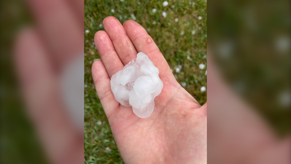
The storm’s very strong updraft also brought loonie-sized hail to Hodsgson, loonie to toonie-sized hail in Eriksdale, and toonie to golf ball-sized hail to Peguis First Nation.
 Golf ball-sized hail reportedly fell south of Baldur on June 20, 2023. (Source: Connie Ricard)
In terms of precipitation, Carberry appeared to receive the most with 42.6 millimetres, mostly falling Tuesday afternoon and overnight. Fisher Branch also reported 39.4 millimetres, while Brandon saw 27.8 millimetres and McCreary observed about 20.5 millimetres.
Hasell said Tuesday’s extreme heat played a role in developing the severe thunderstorms, as well as a frontal structure that was still in effect Wednesday, though it has since migrated to eastern parts of Manitoba.
“In this case, we were expecting a lot of instability to come together with this frontal structure, and the wind profile did suggest a risk of large hail and tornadoes.”
Hasell said while there does not appear to be a looming threat of more severe thunderstorms in the near future, Manitobans should still know what precautions to take in the event one should develop.
She said useful tips can be found on ECCC’s seasonal hazards page.
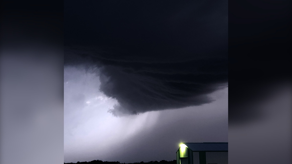
 A grey, nasty cloud formation is pictured near Rivers, Man. on June 20, 2023. (Source: Danielle/Five Star Ranch Inc.)
WINNIPEG JUST SHY OF HEAT RECORD
While Tuesday felt plenty sweltering for many Winnipeggers, it didn’t quite make the meteorological history books. It came just shy of surpassing the heat record of 36.7 C set in 1910.
Yesterday, Winnipeg’s mercury peaked at 35.7.
“Yesterday was the second hottest June 20 since records began,” Hasell said.
CTVNews.ca Top Stories

BREAKING Donald Trump picks former U.S. congressman Pete Hoekstra as ambassador to Canada
U.S. president-elect Donald Trump has nominated former diplomat and U.S. congressman Pete Hoekstra to be the American ambassador to Canada.
Genetic evidence backs up COVID-19 origin theory that pandemic started in seafood market
A group of researchers say they have more evidence to suggest the COVID-19 pandemic started in a Chinese seafood market where it spread from infected animals to humans. The evidence is laid out in a recent study published in Cell, a scientific journal, nearly five years after the first known COVID-19 outbreak.
This is how much money you need to make to buy a house in Canada's largest cities
The average salary needed to buy a home keeps inching down in cities across Canada, according to the latest data.
'My two daughters were sleeping': London Ont. family in shock after their home riddled with gunfire
A London father and son they’re shocked and confused after their home was riddled with bullets while young children were sleeping inside.
Smuggler arrested with 300 tarantulas strapped to his body
Police in Peru have arrested a man caught trying to leave the country with 320 tarantulas, 110 centipedes and nine bullet ants strapped to his body.
Boissonnault out of cabinet to 'focus on clearing the allegations,' Trudeau announces
Prime Minister Justin Trudeau has announced embattled minister Randy Boissonnault is out of cabinet.
Baby dies after being reported missing in midtown Toronto: police
A four-month-old baby is dead after what Toronto police are calling a “suspicious incident” at a Toronto Community Housing building in the city’s midtown area on Wednesday afternoon.
Sask. woman who refused to provide breath sample did not break the law, court finds
A Saskatchewan woman who refused to provide a breath sample after being stopped by police in Regina did not break the law – as the officer's request was deemed not lawful given the circumstances.
Parole board reverses decision and will allow families of Paul Bernardo's victims to attend upcoming parole hearing in person
The families of the victims of Paul Bernardo will be allowed to attend the serial killer’s upcoming parole hearing in person, the Parole Board of Canada (PBC) says.


